The eighteenth century saw the dawn of the great coaching age, but the increase in wheeled traffic led to more damage to the roads, raising the question of who was to pay for it? The development of the turnpike[i] trusts thanks to the General Turnpike Act of 1773 attempted to put the responsibility for upkeep into the hands of road users for until then, the cost of maintaining the roads was borne by the parishes and local landowners, who were expected to provide work teams for a given number of days of the year as well as paying rates which covered the cost of tools and materials (MH3 P495).
The Act allowed the setting up of local Trusts which could levy a toll to cover the cost of repairs on the more major roads. The North Walsham/Norwich Road (now B1150) was turnpiked in 1796-7 from Magdalen Gates in Norwich to the King’s Arms in North Walsham.[ii] There were three toll houses on this stretch of road, one at the Crostwick crossroads, another on the Frettenham Road in Horstead and the third on the Norwich Road just outside North Walsham. The last survives as Stone Cross aka Monument Cottage and is of a typical Norfolk pattern being a long, low bungalow next to the road with side windows to allow a view of approaching traffic. The Horstead one was apparently destroyed by fire in the 1930s[iii] and stood on the corner of the Norwich Road and Frettenham Road opposite the smithy, but changes in the road layout have now destroyed any trace of it. It is shown on the Apportionment to the Tithe Map of 1841 as belonging to the Turnpike Trustees, with a Charles Yallop as toll collector, although later it seems to have become part of the Horstead Hall Estate[iv] and was used as a reading room for the parish. From the descriptions I have been given, it was probably similar in style to Monument Cottage.
Better roads meant better transport. By 1761, the journey time from Norwich to London had reduced from three days to one, although travelling by fast mail coach was expensive. By contrast, moving bulky goods by waggon was more cumbersome, the waggon only being capable of walking speed and having to have wide wheels to avoid their becoming bogged down on soft surfaces of Norfolk’s roads. Where possible, cargo was sent by water as it was cheaper. Existing rivers, and inland staithes or ‘hithes,’ facilitated water transport as did the development of canals such as the one from North Walsham (Antingham) to Dilham and the cuttings from the Bure created in Horstead at the area known as Little Switzerland. It was because sending bulky goods by road was so difficult that when people needed to move house, they usually auctioned off the contents rather than having to move them.
In the middle of the century there was an increase in travel. Better roads allowed the development of lighter vehicles which gave gentlewomen in particular more freedom to travel in comfort without having to ride on horseback. At this time more people favoured cross-country routes, particularly if they could not afford to pay the tolls. The downside of better mobility was the impact on crime. Then, as now, improved roads gave greater opportunity for felons to travel about the country to commit robberies and escape justice.[v]
It is interesting to see from Faden’s (1797) map that the road from Norwich to North Walsham did not follow the route it does today, but makes a detour round the Scottow estate, to Scottow common and the Three Horseshoes pub, through Westwick past Westwick Hall and then following roughly the route we know today. Both Faden’s Map and Paterson’s Roads, an 18th century travel companion, agree that the main road to the North Norfolk coast was to Cromer, with North Walsham merely an offshoot, Cromer being a major port in the Iceland fishery. Interestingly, the Tithe Map also shows several minor routes or trackways emanating from the North Walsham/Norwich Road which have now disappeared.
Next time: the coming of the railway and the end of the turnpike trusts, the rise of the motor car, accidents and complaints about ‘dangerous’ roads.
[i] The term, ’Turnpike,’ was a military one and referred to the method of halting the traffic to exact a toll by placing a pikestaff across the road. On payment of the toll, the pike would be turned aside to allow the traffic to pass.
[ii] The relevant Act is 37 Geo III c. IX.C for those interested!
[iii] See Millican, P. ‘A History of Horstead and Stanninghall,’ H W Hunt. Norwich 1937. Pp 10-11.
[iv] It appears on the sale particulars when the estate was put up for sale in 1908-11. (NRO BR139/43)
[v] See Durston, pp 38-39 for some examples.
Pictures:
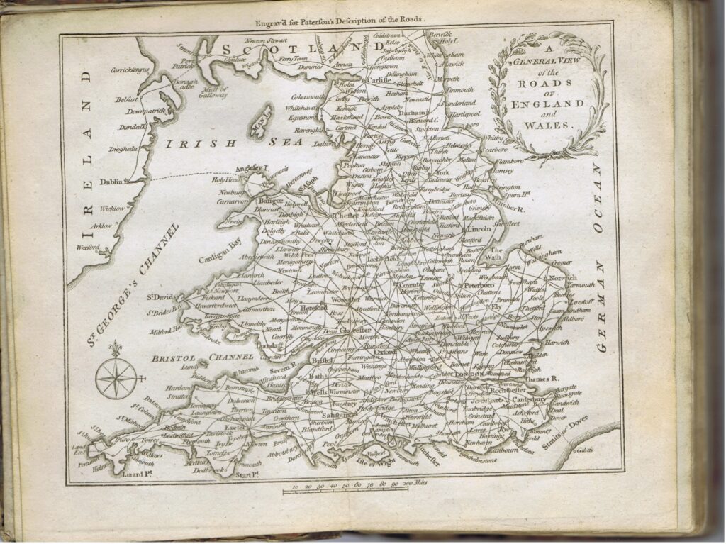
Fig 1: Map from ‘Paterson’s Roads’ showing major routes in the 18th Century. Photo: Author
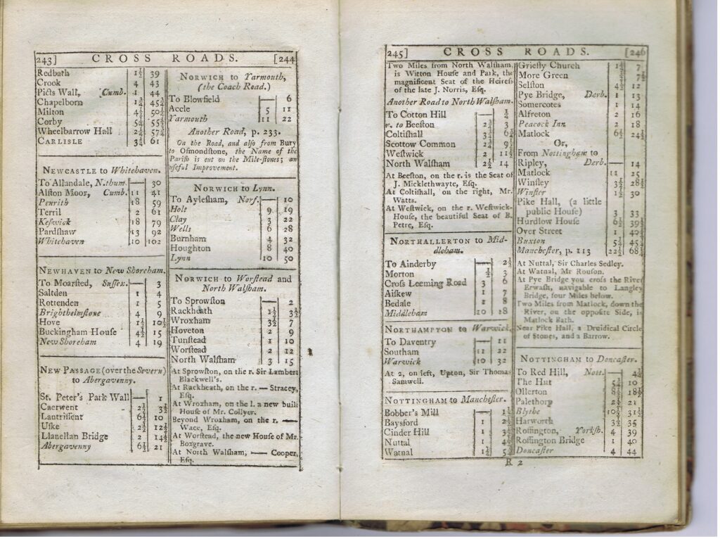
Fig 2: Pages from ‘Paterson’s Roads’ showing two routes from Norwich to North Walsham. The listing of country seats wasn’t just for idle interest. The ‘Upper Sorts’ could ask for and receive hospitality from their equals on their journey.
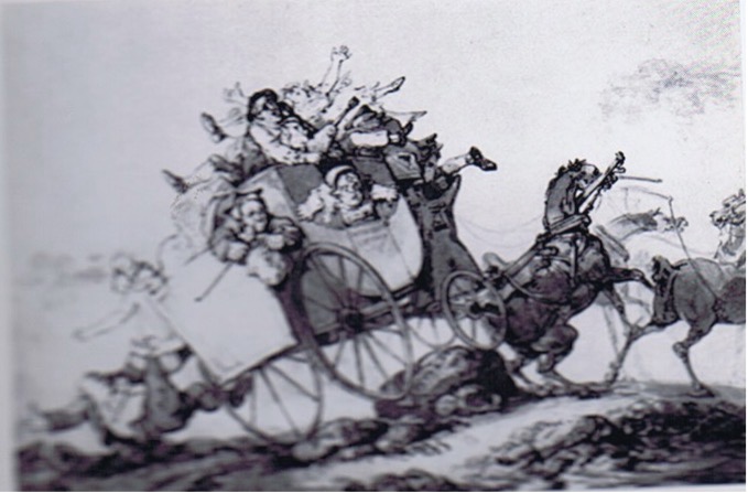
Fig 3: With uneven roads and often overloaded carriages, accidents were not uncommon.
Cartoon from Copeland (1968)
Sources:
In Print:
Barringer, C. A History of Norfolk. Carnegie. Lancaster. 2017
Bird, M. Mary Hardy and Her World. Vol. 1: A Working Family. Vol 3, Spiritual and Social Forces. Vol 4: Under Sail and Under Arms. Burnham Press. Kingston-Upon-Thames. 2020.
Burke, T. Travel in England: From Pilgrim and Packhorse to Light Car and Plane. Batsford. London. 1942.
Copeland, J. Roads and Their Traffic 1750-1850. David & Charles Newton Abbot. 1968
Durston, G J. Fields, Fens and Felonies. Waterside Press. Hants. 2016.
Faden, W. A Map of the County of Norfolk. Lark’s Press. Dereham. 1989 Reprint of 1797 Original.
Jones, A (Ed). Baskerville, T. Journeys in Industrious England. Hobnob Press. Gloucester. 2023 (Annotated Edition of Work c 1682).
Millican, P. A History of Horstead and Stanninghall. H W Hunt. Norwich.1937.
Paterson, D. A New and Accurate Description of All the Direct and Principal Cross Roads in England and Wales. T Carman. London. 1786
Robinson, B & Rose E. Norfolk Origins 2: Roads and Tracks. Poppyland. 1983.
Taylor, C. Roads and Tracks of Britain. J M Dent & Sons London. 1979.
Taylor, P. The Tollhouses of Norfolk. Polystar Press. Ipswich. 2009
Online:
The Milestone Society: https://www.milestonesociety.co.uk/
Other:
Norfolk Record Office (NRO) See text for references.
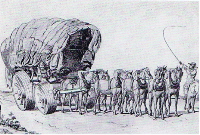
Fig 4: Waggon and team. Note the wide wheels to prevent sinking into soft ground. These cumbersome vehicles could only manage 3-4 miles per hour.